Tat Ali Volcano
Updated: Apr 28, 2024 09:36 GMT -
Shield volcano 700+ m / 2,297 ft
Ethiopia, 13.28°N / 41.07°E
Current status: normal or dormant (1 out of 5)
Ethiopia, 13.28°N / 41.07°E
Current status: normal or dormant (1 out of 5)
[smaller] [larger]
Tat Ali volcano eruptions: unknown, no recent eruptions
Latest nearby earthquakes
| Time | Mag. / Depth | Distance / Location | |||
Background
Tat Ali volcano is the dominant feature of the Tat Ali Range, east of Lake Afrera. The low Holocene shield volcano has an elongated summit depression and has produced a variety of rock types, ranging from basalts to pantellerites. NNW-SSE-trending fissures cutting the volcano have fed basaltic lava flows; those NE of Lake Afrera are of prehistorical age. Late-stage volcanism produced youthful basaltic lava flows on the floor of the summit depression, which is also the site of prominent fumarolic activity.---
Smithsonian / GVP volcano information
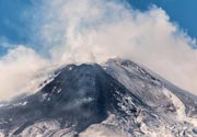
Tat Ali Volcano Photos
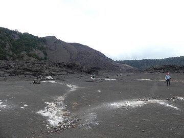
Steam rises up along some of the cracks in the lava lake's surface, precipitating white mineralisations of mostly calcium sulfates and silica (Photo: Ingrid Smet)
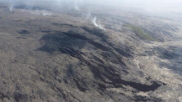
Extension day 3: Older lava flows that came down the pali left a kipuka (vegetation island) behind. More recent surface lava outbreaks are recognisable by their dark brow...
July 27. Will the dam hold and contain the lava flow to the other side? Spectators, mostly journalists watch the lava flow invading La Sapienza. (Photo: Tom Pfeiffer)
Latest satellite images