| RSS | EN | DE | EL | ES | FR | IT | RU

Una Una Volcano

Updated: May 21, 2025 13:46 GMT -
stratovolcano
Sulawesi & Sangihe Islands (Indonesia), -0.17°S / 121.61°E
Summit height: 507 m / 1,663 ft
Current status: normal or dormant (1 out of 5)
Last update: 27 Jan 2025
Fumarole field at Una Una volcano in Jan 2025 (image: T Heuer)

Una Una (also known as Colo) is an isolated volcano in the Gulf of Tomni, offshore central Sulawesi. It is the site of sulfur extraction.

[smaller] [larger]
Typical eruption style: Explosive
Una Una volcano eruptions: 1983, 1938, 1898-1900 (?)

Latest nearby earthquakes

Date and TimeMag / DepthDistance / Location
May 10, 11:08 pm (Universal Time)
2.2

16 km
29 km (18 mi) to the NW Minahassa Peninsula, Sulawesi Info

Background

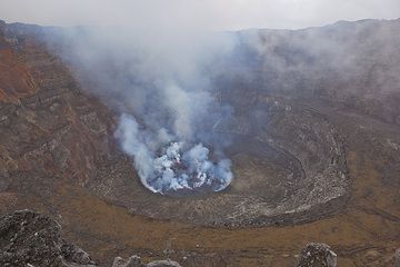
Una Una volcano is a broad, low volcano containing a 2-km-wide caldera with a small central cone. Only 3 eruptions are known in historic time, but 2 of them caused extensive damage over much of the island. The last eruption of Una Una was in 1983 and produced pyroclastic flows that swept over most of the island shortly after all residents had been evacuated.

Una Una Volcano Photos

Significant volcanic eruptions: Una Una volcano

In the past 10,000 years, Una Una has had at least 3 confirmed eruptions, all documented by historical records or observations.
The table below lists all known eruptions (date in bold face) of Una Una volcano in historic times and during the past 10,000 years. Updates on the most recent volcanic activity of Una Una can be found on the news page of Una Una volcano.
DateNoteVEIDeathsDamage
1983 Jul 18 - Dec 16 ±15 d.Gunung Colo
Historical obs./docs.
4
1983 Jul 23
(eruption 1983 Jul 18 - Dec 16 ±15 d.)
Historical obs./docs.
4
moderate
Info
1938 ±10 y.Gunung Colo
Historical obs./docs.
1
1898 May 2 - 1900 ?Gunung Colo
Historical obs./docs.
3?
Remark:
Our list of volcanic eruptions closely follows the database of eruptions of the Smithsonian's Global Volcanism Project (GVP), the internationally most recognized data source for volcanic eruptions, but also includes significant eruptive episodes or related volcano events. "Volcanic eruptions" are usually to be understood as sequences of individual eruptive episodes that can follow each other, or even overlap (if several vents are involved), and can last many years, decades or even longer. For example, the current activity of Stromboli volcano is understood as a single eruption that has been ongoing since 1934.
Sources: NOAA National Centers for Environmental Information (NCEI), Global Significant Volcanic Eruptions Database. doi:10.7289/V5TD9V7K | Global Volcanism Project / Smithsonian Institution

Una Una Volcano FAQ

+When was the last eruption of Una Una volcano?

+How often does Una Una volcano erupt?

+How active is Una Una volcano at present?

+When was the largest eruption of Una Una volcano?

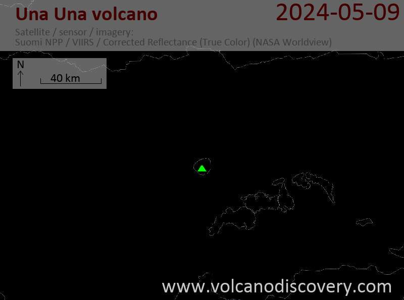
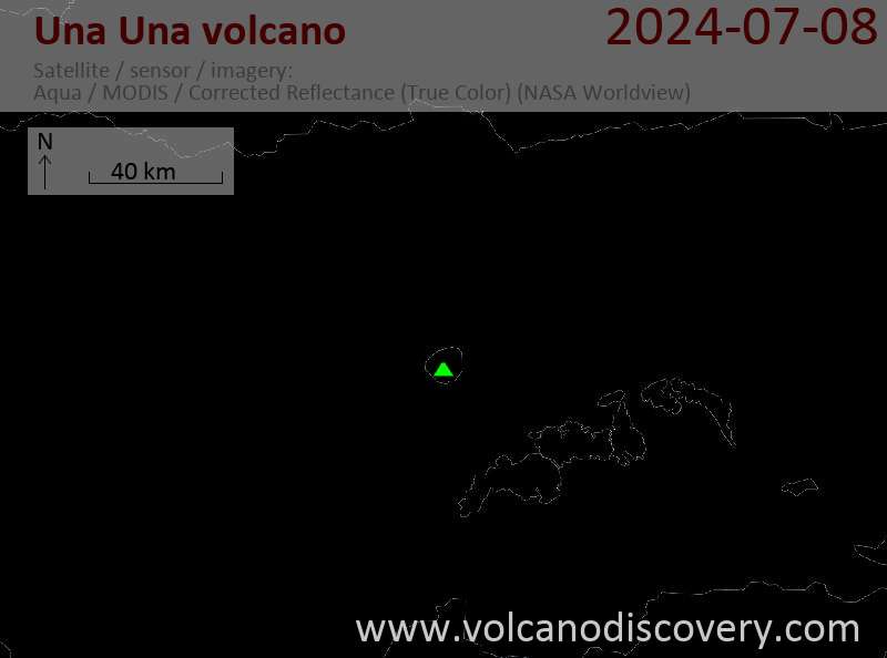
Latest satellite images

UnaUna satellite image sat1UnaUna satellite image sat2

Una Una Volcano Maps

Below is a selection of maps showing the location and surroundings of the volcano at various resolutions based on aerial-imagery / terrain maps. Feel free to use them for non-commercial purposes on your blog or website as long as you credit them with a link back to this page (click to copy it).
Satellite/aerial-type map of Una Una volcano (world scale)
Terrain-type map of Una Una volcano (world scale)
Satellite/aerial-type map of Una Una volcano (region scale large)
Terrain-type map of Una Una volcano (region scale large)
Satellite/aerial-type map of Una Una volcano (region scale medium)
Terrain-type map of Una Una volcano (region scale medium)
Satellite/aerial-type map of Una Una volcano (region scale small)
Terrain-type map of Una Una volcano (region scale small)
Satellite/aerial-type map of Una Una volcano (local scale large)
Terrain-type map of Una Una volcano (local scale large)
Satellite/aerial-type map of Una Una volcano (local scale medium)
Terrain-type map of Una Una volcano (local scale medium)
Satellite/aerial-type map of Una Una volcano (local scale small)
Terrain-type map of Una Una volcano (local scale small)
Satellite/aerial-type map of Una Una volcano (scale of 10s of km)
Terrain-type map of Una Una volcano (scale of 10s of km)
Satellite/aerial-type map of Una Una volcano (scale of 20-40 km)
Terrain-type map of Una Una volcano (scale of 20-40 km)
Satellite/aerial-type map of Una Una volcano (scale of approx. 10-20 km)
Terrain-type map of Una Una volcano (scale of approx. 10-20 km)
Satellite/aerial-type map of Una Una volcano (scale of 5-10 km)
Satellite/aerial-type map of Una Una volcano (scale of few kilometers)
Volcanoes & Earthquakes - new app for Android
Guaranteed tours
9-25 Jun 2025: Volcanoes and Spices - Sulawesi/Halmahera (Indonesia)
7-22 Jul 2025: From Krakatau to Bali - Java (Indonesia)
7-23 Jul 2025: Volcanoes and Spices - Sulawesi/Halmahera (Indonesia)
1-17 Aug 2025: Volcanoes and Spices - Sulawesi/Halmahera (Indonesia)
1-14 Oct 2025: Desert, salt and volcanoes - Danakil desert (Ethiopia)
4-12 Oct 2025: From Stromboli to Etna - Sicily and Eolian Islands (Italy)
6-21 Oct 2025: From Krakatau to Bali - Java (Indonesia)
3-19 Nov 2025: Volcanoes and Spices - Sulawesi/Halmahera (Indonesia)
= spaces available   = guaranteed   = few spaces left   = booked out
Mon, 2 Nov 2015, 06:58

Colo (Una Una) volcano, Sulawesi (Indonesia): alert level lowered to normal

Seismic activity at Colo Una Una volcano during the past months
A recent period of volcanic unrest seems to be over. Seismic activity has decreased and VSI lowered its alert level back to green (normal) last week. ... Read all
Wed, 28 Oct 2015, 06:00

Colo volcano (Sulawesi, Indonesia) - Smithsonian / USGS Weekly Volcanic Activity Report for 28 October-3 November 2015 (Continuing Activity)

PVMBG reported that seismicity at Colo declined during 1 September-25 October; 1-7 shallow-volcanic earthquakes and 1-3 volcanic earthquakes were recorded per day, which were rates similar to those recorded before a seismic increase in June. The Alert Level was lowered to 1 (on a scale of 1-4) on 26 October, and residents and tourists were warned not to approach the crater. ... Read all

On this page:

Try our free app!
Volcanoes & Earthquakes - new app for Android
Android | iOS version

More on VolcanoDiscovery

Why is there advertising on this site?

Support us - Help us upgrade our services!

We truly love working to bring you the latest volcano and earthquake data from around the world. Maintaining our website and our free apps does require, however, considerable time and resources.
We need financing to increase hard- and software capacity as well as support our editor team. We're aiming to achieve uninterrupted service wherever an earthquake or volcano eruption unfolds, and your donations can make it happen! Every donation will be highly appreciated. If you find the information useful and would like to support our team in integrating further features, write great content, and in upgrading our soft- and hardware, please make a donation (PayPal).

Planned features:Thanks to your past donations, these features have been added recently:
Download and Upgrade the Volcanoes & Earthquakes app to get one of the fastest seismic and volcano alerts online:
Android | IOS
Thank you!
Sources: VolcanoDiscovery / VolcanoAdventures and other sources as noted.
Use of material: Most text and images on our websites are owned by us. Re-use is generally not permitted without authorization. Contact us for licensing rights.
Volcanoes & Earthquakes
VolcanoDiscovery Home
Volcanoes | Earthquakes | Photos | Volcano News | | Shop | App
Adventure & Study Travel
Tours to Volcanoes and Volcanic Areas: walking tours, photo tours, study tours
Tours & Dates | FAQ | About us
Get our newsletter!
Company info
Contact | Legal info | Terms & conditions
Follow us
Follow us on facebook Follow us on Instagram Follow us on Bluesky Follow us on Twitter Visit our Youtube channel
EN | DE | EL | ES | FR | IT | RU
VolcanoDiscovery GmbH, Germany, Reg. nr.: HRB 103744, EU Tax Id: DE 297 465 123 owned and created by
Dr. Tom Pfeiffer, volcanologist, volcano photographer, tour organizer member of
IAVCEI
IAVCEI
Vulkanologische Gesellschaft
Volcanological Society
Ecotourism Greece
Ecotourism Greece
RUV insurance
Insured by R+V
VolcanoDiscovery © 2004- All Rights Reserved | Privacy - Cookie Settings