Krakatau Volcano

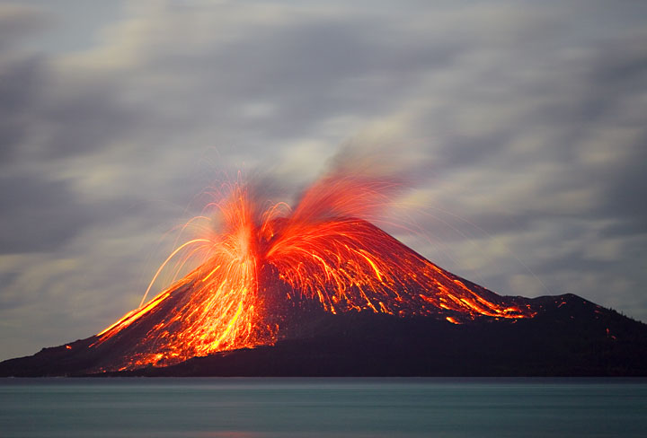
Krakatau, a small island group in the Sunda Strait between the islands of Sumatra and Java is one of the world's most famous volcanoes. It is a mostly submerged caldera with 3 outer islands belonging to the rim and a new cone, Anak Krakatau, that has been forming a new island since 1927 and remains highly active.
Krakatau exploded spectacularly in a devastating Plinian eruption 1883 that killed more than 30,000 people (mostly by the huge tsunamis triggered by the eruption). The eruption was one of the first global news events after telegraph lines had connected the different continents.
Krakatau volcano eruptions: 1530, 1680-81, 1684, 1883 (Plinian eruption), 1927-30, 1931-32, 1932-34, 1935, 1936, 1937, 1938-40, 1941, 1942, 1943, 1944, 1945, 1946, 1946-47, 1949, 1950, 1952, 1953, 1955, 1958-59, 1959-63, 1965(?), 1969(?), 1972-73, 1975, 1978, 1979, 1980, 1981, 1988, 1992-93, 1994-95, 1996, 1997, 1999, 2000, 2001, 2007-8, April 2009-early 2010, Oct 2010 - March 2011, July-Oct 2011, Jan-May + Sep 2012, 2015(?), 2017, 2018 (22 Dec eruption & tsunami), 2019-ongoing
Latest nearby earthquakes
| Date and Time | Mag / Depth | Distance / Location | |||
|---|---|---|---|---|---|
Background
The renowned volcano Krakatau (or Krakatoa) lies in the Sunda Strait between Java and Sumatra. Collapse of the ancestral Krakatau edifice, perhaps in 416 AD, formed a 7-km-wide caldera. Remnants of this ancestral volcano are preserved in Verlaten and Lang Islands; subsequently Rakata, Danan and Perbuwatan volcanoes were formed, coalescing to create the pre-1883 Krakatau Island. Caldera collapse during the catastrophic 1883 eruption destroyed Danan and Perbuwatan volcanoes, and left only a remnant of Rakata volcano. This eruption, the 2nd largest in Indonesia during historical time, caused more than 36,000 fatalities, most as a result of devastating tsunamis that swept the adjacent coastlines of Sumatra and Java. Pyroclastic surges traveled 40 km across the Sunda Strait and reached the Sumatra coast. After a quiescence of less than a half century, the post-collapse cone of Anak Krakatau (Child of Krakatau) was constructed within the 1883 caldera at a point between the former cones of Danan and Perbuwatan. Anak Krakatau has been the site of frequent eruptions since 1927.---
Source: GVP, Smithsonian Institution
Krakatau Volcano Photos


Significant volcanic eruptions: Krakatau volcano
| Date | Note | VEI | Deaths | Damage | |
|---|---|---|---|---|---|
| Anak Krakatau Historical obs./docs. | 2 | ||||
| Anak Krakatau Historical obs./docs. | 3 | ||||
| 2018 Dec 22 (eruption | Tsunami recorded Historical obs./docs. | 3 | 437 | very heavy | Info |
| Summit crater Historical obs./docs. | 1 | ||||
| Anak Krakatau Historical obs./docs. | 1 | ||||
| Anak Krakatau Historical obs./docs. | 1 | ||||
| Anak Krakatau Historical obs./docs. | 1 | ||||
| Anak Krakatau Historical obs./docs. | 2 | ||||
| Anak Krakatau Historical obs./docs. | 2 | ||||
| Anak Krakatau Historical obs./docs. | 2 | ||||
| Anak Krakatau Historical obs./docs. | 2 | ||||
| Anak Krakatau Historical obs./docs. | 1 | ||||
| Anak Krakatau Historical obs./docs. | 1 | ||||
| Anak Krakatau Historical obs./docs. | 2 | ||||
| Anak Krakatau Historical obs./docs. | 2 | ||||
| Anak Krakatau Historical obs./docs. | 2 | ||||
| Anak Krakatau Historical obs./docs. | 2 | ||||
| Anak Krakatau Historical obs./docs. | 1 | ||||
| 1993 Jun 13 (eruption | Historical obs./docs. | 1 | 1 | Info | |
| Anak Krakatau (S flank 1960-81 cone) Historical obs./docs. | 2 | ||||
| Anak Krakatau Historical obs./docs. | 1 | ||||
| 1981 Oct 20 (eruption | Tsunami recorded Historical obs./docs. | 1 | Info | ||
| Anak Krakatau Historical obs./docs. | 2 | ||||
| Anak Krakatau Historical obs./docs. | 2 | ||||
| Anak Krakatau Historical obs./docs. | 1 | ||||
| Anak Krakatau Historical obs./docs. | 2 | ||||
| Anak Krakatau Historical obs./docs. | 2 | ||||
?? | Uncertain Eruption | 2? | |||
| Anak Krakatau Historical obs./docs. | 1? | ||||
| Anak Krakatau Historical obs./docs. | 2 | ||||
| Anak Krakatau Historical obs./docs. | 2 | ||||
| Anak Krakatau Historical obs./docs. | 2 | ||||
| Anak Krakatau Historical obs./docs. | 2 | ||||
| Anak Krakatau Historical obs./docs. | 2 | ||||
| Anak Krakatau Historical obs./docs. | 2 | ||||
| Anak Krakatau Historical obs./docs. | 2 | ||||
| Anak Krakatau Historical obs./docs. | 2 | ||||
| Anak Krakatau Historical obs./docs. | 2 | ||||
| Anak Krakatau Historical obs./docs. | 1 | ||||
| Anak Krakatau Historical obs./docs. | 2 | ||||
| Anak Krakatau Historical obs./docs. | 2 | ||||
| Anak Krakatau Historical obs./docs. | 2 | ||||
| Anak Krakatau Historical obs./docs. | 2 | ||||
| Anak Krakatau Historical obs./docs. | 2 | ||||
| Anak Krakatau Historical obs./docs. | 3 | ||||
| Anak Krakatau Historical obs./docs. | 2 | ||||
| Anak Krakatau Historical obs./docs. | 1 | ||||
| Anak Krakatau Historical obs./docs. | 2 | ||||
| Anak Krakatau Historical obs./docs. | 3 | ||||
| Anak Krakatau Historical obs./docs. | 2 | ||||
| Anak Krakatau Historical obs./docs. | 2 | ||||
| 1930 Mar 17 (eruptive episode | Tsunami recorded Historical obs./docs. | 2 | Info | ||
| 1928 Mar 26 (eruption | Tsunami recorded Historical obs./docs. | 2 | Info | ||
Krakatau Volcano FAQ
+When was the last eruption of Krakatau volcano?
The last confirmed eruption of Krakatau occurred during 2021 - 2023.
+How often does Krakatau volcano erupt?
Since 250 AD, Krakatau volcano has had at least 58 historically documented eruptions. This means that it erupts on average every 30.6 years.
Many eruptions of Krakatau have lasted more than one year. In total, the volcano has been in eruption during 77 out of 1775 years until now. In other words, Krakatau has been active at least one in 23.1 years on average. Note that this value is likely an underestimate, because the known history of eruptions from Krakatau is likely incomplete, especially further back in time.
+How active is Krakatau volcano at present?
Krakatau volcano is extremely active: Since 1900, it has been frequently active, showing eruptive activity during 65 years out of 126 as of now. The last eruption was from 2021 until 2023 and ended 2 years ago.
+When was the largest eruption of Krakatau volcano?
The largest eruption of Krakatau volcano in historic times occurred in 1883. It ranks as a plinian eruption with a magnitude 6 on the VEI (Volcanic Explosivity Index) scale. Eruption of this size are often catastrophic on a regional scale.
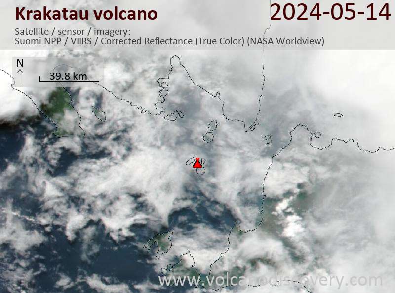
Latest satellite images
Price 3180 €
Price 1340 €
Price 1750 EUR (7d) / 2480 EUR (10d)
Krakatau Volcano Maps


