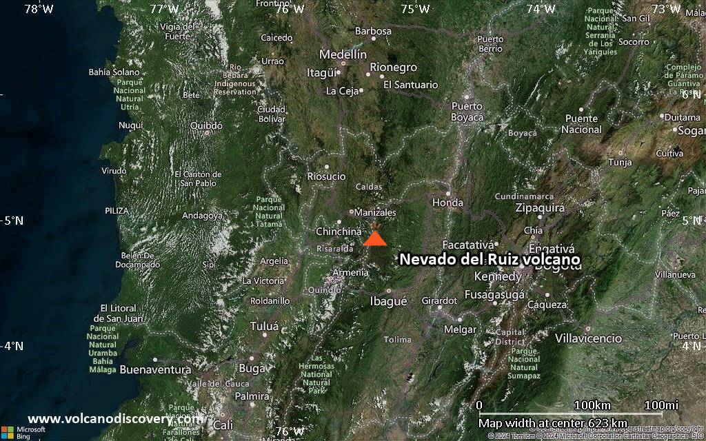
Colombia has 15 volcanoes considered active. The volcanoes are related to the subduction zone that runs along the whole of America's western plate margin. Colombia's volcanoes are part of the northern Andes and lie at the junction of 3 tectonic plates, the Nazca, Caribbean and South American plates.
| Date | Volcano | VEI | Region | Deaths | Damage | |
|---|---|---|---|---|---|---|
| Nevado del Ruiz Arenas crater | 2 | Colombia | ||||
| Puracé | 1 | Colombia | ||||
| Puracé Between Puracé and Curiquinga | 1 | Colombia | ||||
| Galeras Summit crater | 2 | Colombia | ||||
| Nevado del Ruiz Arenas Crater | 3 | Colombia | ||||
| Nevado del Huila Upper SW side of Pico Central | 3? | Colombia | ||||
| Galeras Central cone | 1 | Colombia | ||||
| Galeras | 3 | Colombia | ||||
| 2008 Nov 20 (eruptive episode | Nevado del Huila | 0 | Colombia | 10 | Info | |
| Nevado del Huila | 2? | Colombia | ||||
| Galeras | 3? | Colombia | ||||
| Nevado del Huila | 3? | Colombia | ||||
| 2007 Apr 18 (eruption | Nevado del Huila | 0 | Colombia | moderate | Info | |
| Galeras | 2 | Colombia | ||||
| Galeras El Pinta vent | 3 | Colombia | ||||
| Galeras El Pinta vent | 1? | Colombia | ||||
| Galeras | 1 | Colombia | ||||
| Galeras Summit crater, west, SW, & south rims | 2 | Colombia | ||||
| 1993 Jan 14 (eruption | Galeras | 2 | Colombia | 9 | Info | |
| Galeras | 2 | Colombia | ||||
| Nevado del Ruiz Arenas Crater | 3 | Colombia | ||||
| Galeras El Pinta vent | 2 | Colombia | ||||
| 1985 Nov 13 (eruption | Nevado del Ruiz | 3 | Colombia | 23,080 | Info | |
| Nevado del Ruiz Arenas Crater | 1 | Colombia | ||||
| Galeras | 1? | Colombia | ||||
| Puracé | 2 | Colombia | ||||
| Puracé | 2? | Colombia | ||||
| Puracé | 2 | Colombia | ||||
| Galeras | 2 | Colombia | ||||
| Puracé | 2 | Colombia | ||||
| 1949 May 26 (eruption | Puracé | 2 | Colombia | 17 | Info | |
| Puracé | 2 | Colombia | ||||
| Puracé | 2 | Colombia | ||||
| Nevado del Tolima | 2 | Colombia | ||||
| Galeras | 2 | Colombia | ||||
| 1936 Aug 14 (eruptive episode | Doña Juana | 0 | Colombia | 18 | Info | |
| Cerro Negro de Mayasquer Volcano Uncertain: possibly Reventador | 2 | Colombia / Ecuador | ||||
| Galeras | 2 | Colombia | ||||
| Cumbal | 2 | Colombia | ||||
| Puracé | 2 | Colombia | ||||
| Galeras | 3 | Colombia | ||||
| Puracé | 2 | Colombia | ||||
| Puracé | 2 | Colombia | ||||
| Galeras | 2 | Colombia | ||||
| Puracé | 2 | Colombia | ||||
| Nevado del Ruiz | 2 | Colombia | ||||
| Puracé | 2 | Colombia | ||||
| Doña Juana | 4 | Colombia | ||||
| Puracé | 2 | Colombia | ||||
| 1899 Nov 13 (eruption | Doña Juana | 4 | Colombia | 55 | Info | |
The last volcanic eruption in Colombia was from Puracé volcano in 2023.
The first historically documented eruption occurred around 1535 AD from Galeras volcano.
Since 1535 AD, Colombia has seen at least 81 historically documented eruptions. This means that a volcano erupts on average every 6 years.
Colombia is volcanically very active: Since 1900, at least 8 volcanoes in Colombia have been active.Since 1900, Colombia has had 43 volcanic eruptions from 8 individual volcanoes. Volcanic eruptions have been recorded erupted during 66 years out of 126 as of now. This means, at least one volcano in Colombia has been in eruption in one in 1.9 years on average. The last volcano to erupt in Colombia was Puracé volcano, which erupted in 2023, 2 years ago.
The largest eruption in Colombia in historic times was from Doña Juana volcano. It occurred during 1897 - 1906. It ranks as a sub-plinian eruption with a magnitude 4 on the VEI (Volcanic Explosivity Index) scale.
| Date and Time | Mag / Depth | Nearest Volcano / Location | |||
|---|---|---|---|---|---|
| Oct 31, 10:54 pm (Bogota) | 3.6 32 km | 326 km (203 mi) E of | 38 km north of Villanueva, Departamento de Casanare, Colombia I FELT IT | Info | |
| Friday, October 31, 2025 GMT (1 quake) | |||||
| Oct 31, 09:41 am (Bogota) | 3.5 147 km | 234 km (145 mi) NE of | Los Santos - Santander, Colombia I FELT IT | Info | |
| Thursday, October 30, 2025 GMT (1 quake) | |||||
| Oct 30, 09:22 am (Bogota) | 4.0 145 km | 231 km (144 mi) NE of | Los Santos - Santander, Colombia I FELT IT | Info | |
| Tuesday, October 28, 2025 GMT (1 quake) | |||||
| Oct 28, 12:44 pm (Bogota) | 3.7 29 km | 283 km (176 mi) NW of | Carmen Del Darién (Curbaradó) - Chocó, Colombia I FELT IT | Info | |
| Monday, October 27, 2025 GMT (1 quake) | |||||
| Oct 27, 08:49 am (Caracas) | 4.4 0 km | 715 km (444 mi) NE of | Cerca De La Costa De Venezuela I FELT IT | Info | |
| Sunday, October 26, 2025 GMT (1 quake) | |||||
| Oct 26, 12:23 pm (GMT -5) | 4.4 246 km | 276 km (171 mi) NW of | North Pacific Ocean, 117 km west of Isla Gorgona Island, Colombia I FELT IT - 1 report | Info | |
| Saturday, October 25, 2025 GMT (1 quake) | |||||
| Oct 25, 04:57 am (Bogota) | 3.6 23 km | 53 km (33 mi) SE of | Santiago - Putumayo, Colombia - Area De Influencia Campo Monogenetico Guamez-Sibundoy I FELT IT | Info | |
| Date | Mag | Region | Deaths | Damage | |
|---|---|---|---|---|---|
| 1999 Jan 25 | 6.2 | Armenia, Calarca, Pereira, Caldas, Huila | 1,185 | catastrophic | Info |
| 1995 Feb 8 | 6.4 | Cali, Pereira, Armenia, Calarca | 45 | heavy | Info |
| 1994 Jun 6 | 6.8 | Cauca, Huila | 650 | light | Info |
| 1992 Oct 18 | 7.4 | Murindo, Apartado, Medellin | 11 | moderate | Info |
| 1983 Mar 31 | 4.9 | Sw, Popayan | 350 | very heavy | Info |
| 1981 Oct 18 | 5.4 | Venezuela-n Colombia | 15 | moderate | Info |
| 1979 Dec 12 | 8.1 | Off Shore, Pacific Ocean | 600 | moderate | Info |
| 1979 Nov 23 | 6.4 | Manizales-armenia | 72 | heavy | Info |
| 1967 Jul 29 | 6.8 | Colombia | 20 | light | Info |
| 1967 Feb 9 | 7.0 | Huila, Neiva, Rivera, San Antonio | 98 | heavy | Info |
| 1962 Jul 30 | 6.8 | Mistrato, Manizales | 47 | heavy | Info |
| 1961 Dec 20 | 6.8 | Eje Cafetero | 23 | moderate | Info |
| 1958 Feb 1 | 6.9 | Colombia-ecuador | 1-50 (*) | heavy | Info |
| 1950 Jul 9 | 6.1 | Anboledas | 300 | heavy | Info |
| 1936 Jan 9 | 5.6 | Colombia | 250 | moderate | Info |
| 1923 Dec 14 | 6.2 | Ipiales | 300 | moderate | Info |
The deadliest earthquake in Colombia since 1900 was the magnitude 6.2 earthquake in ![]() Colombia, Quindio Department on Jan, 25, 1999. It resulted in 1,185 fatalities and 4,750 injured people. This was the most disastrous quake in Colombia ever recorded.
Colombia, Quindio Department on Jan, 25, 1999. It resulted in 1,185 fatalities and 4,750 injured people. This was the most disastrous quake in Colombia ever recorded.
Since 1900, at least 33 earthquakes claimed an estimated total of 4,054 fatalities in Colombia.
There were 46 damaging or deadly quakes during this period that caused economic losses of approx. $2.7 billion US Dollars combined.