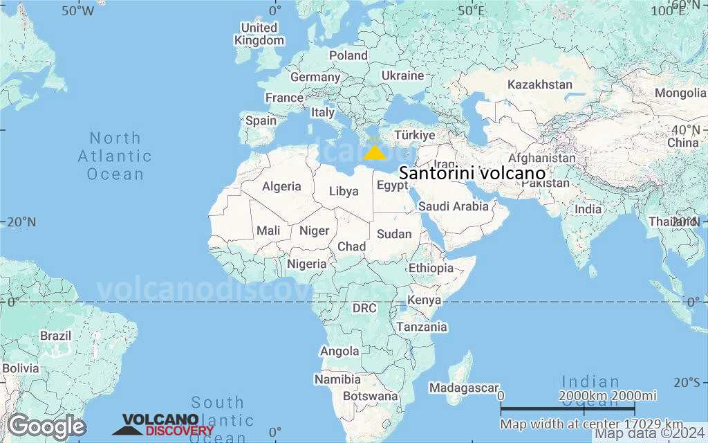
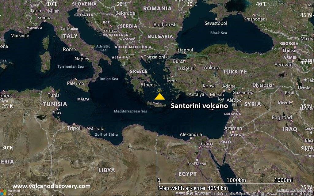
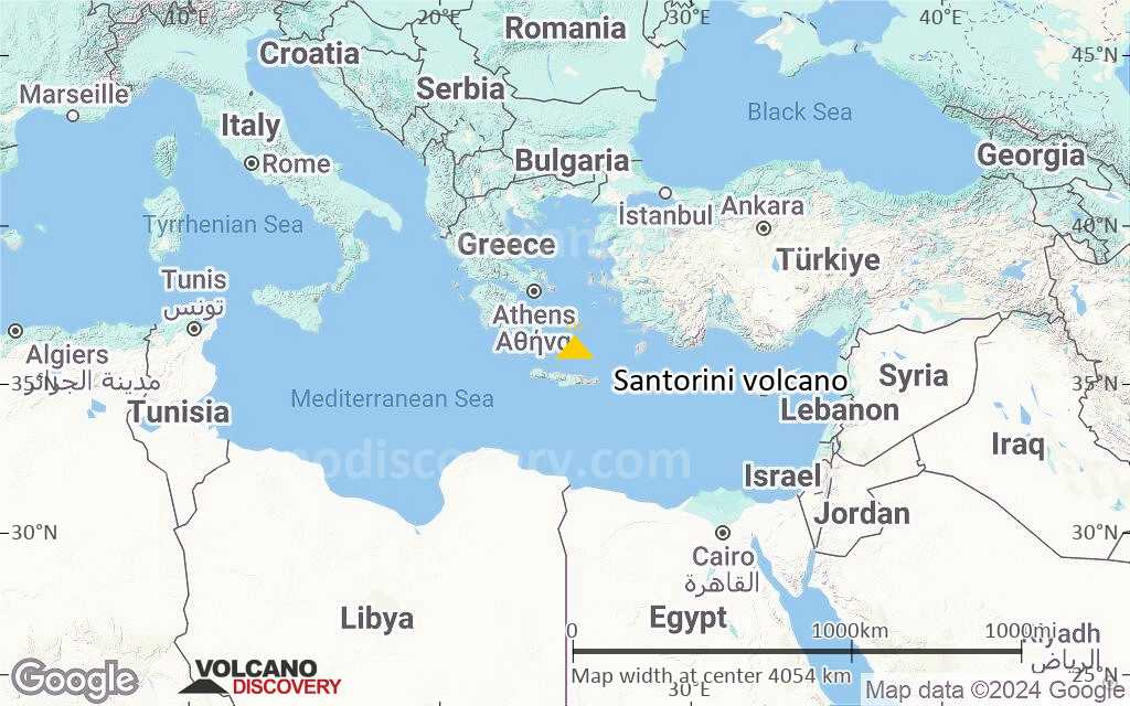
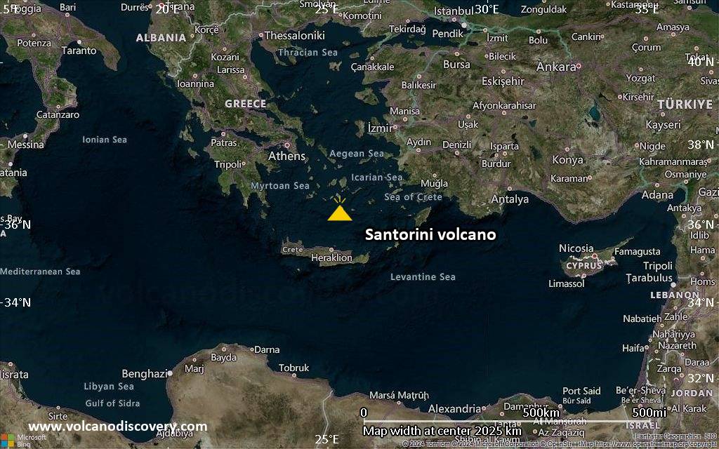
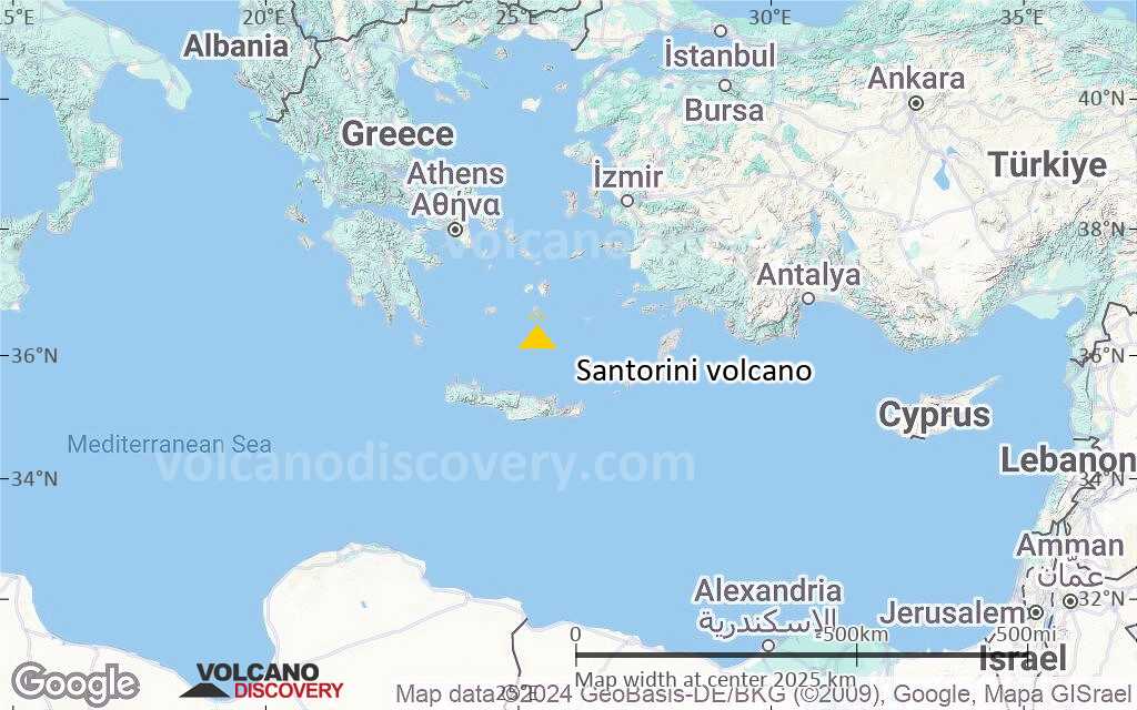
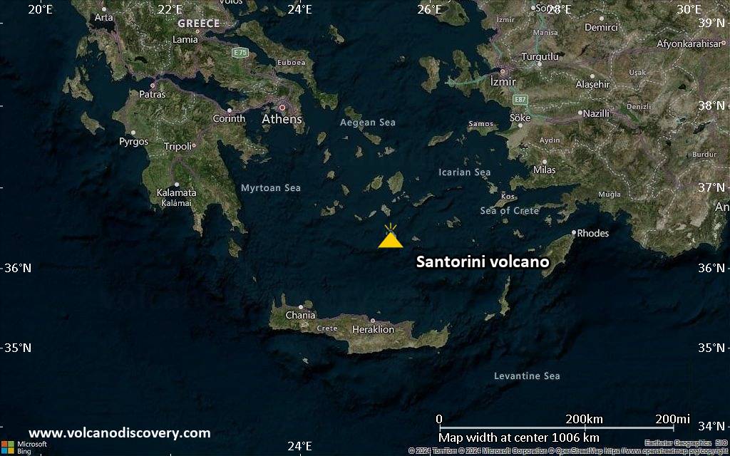
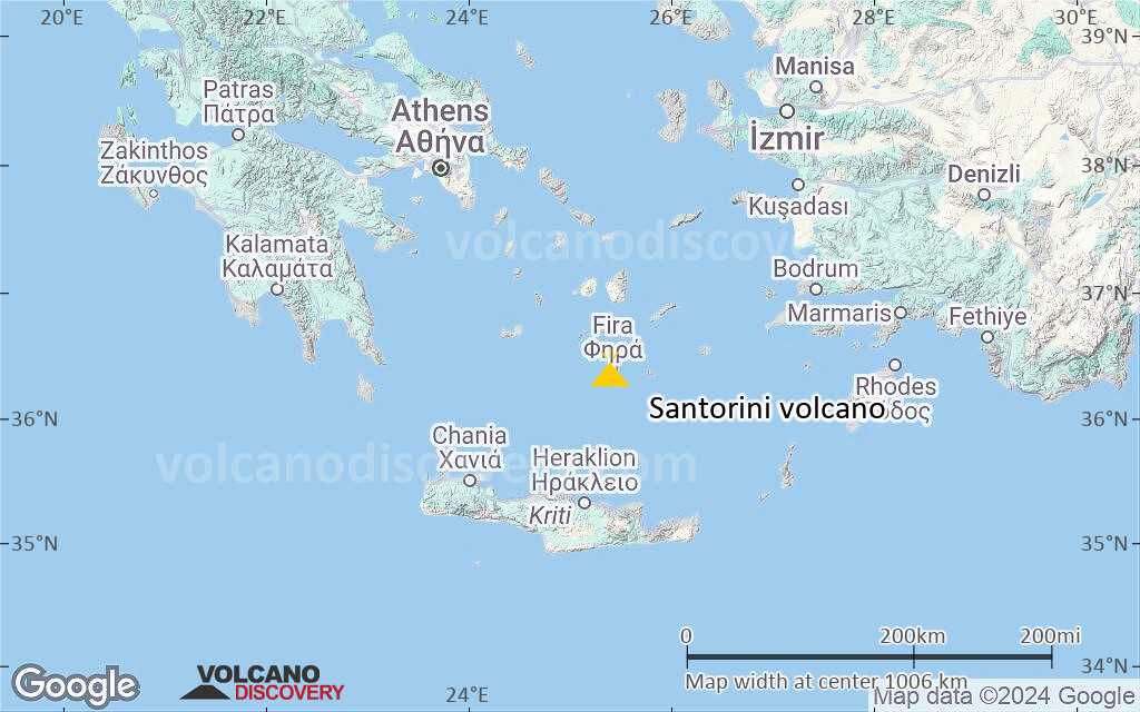
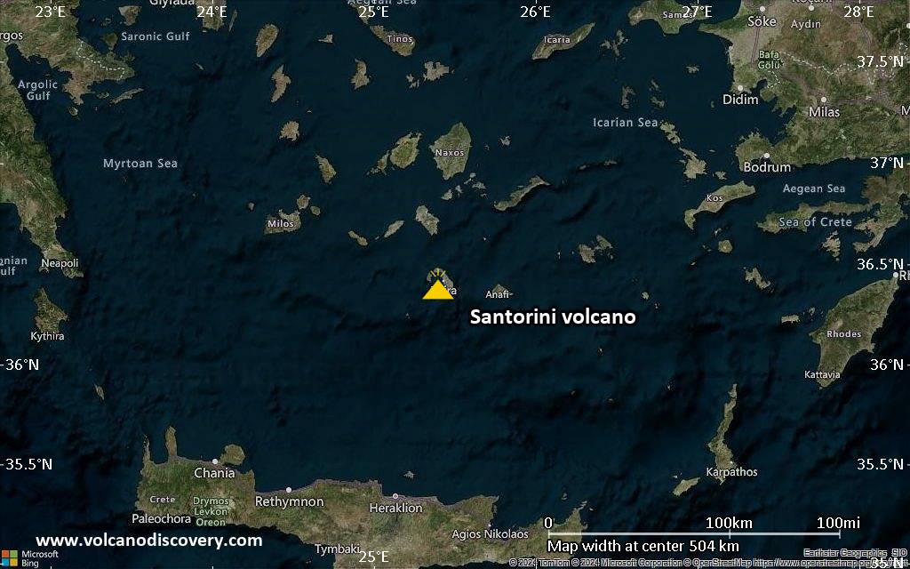
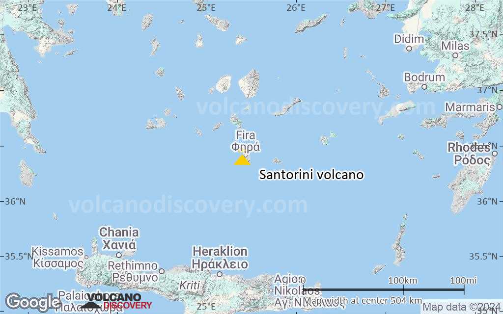
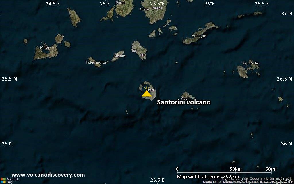
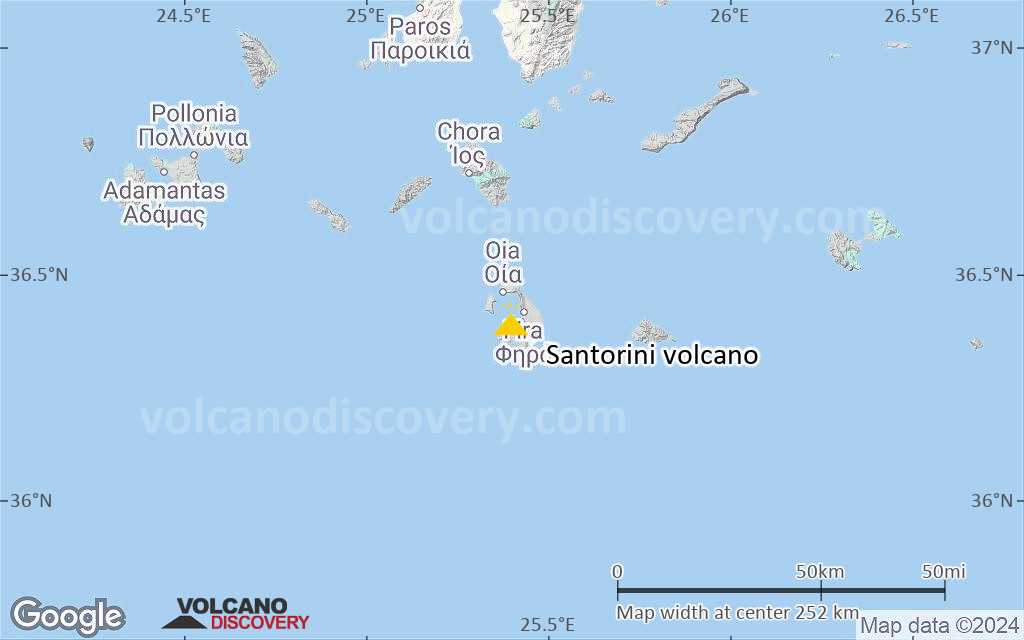
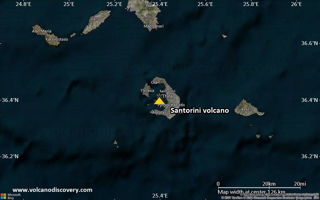
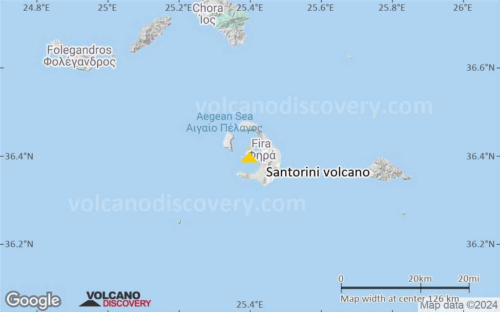
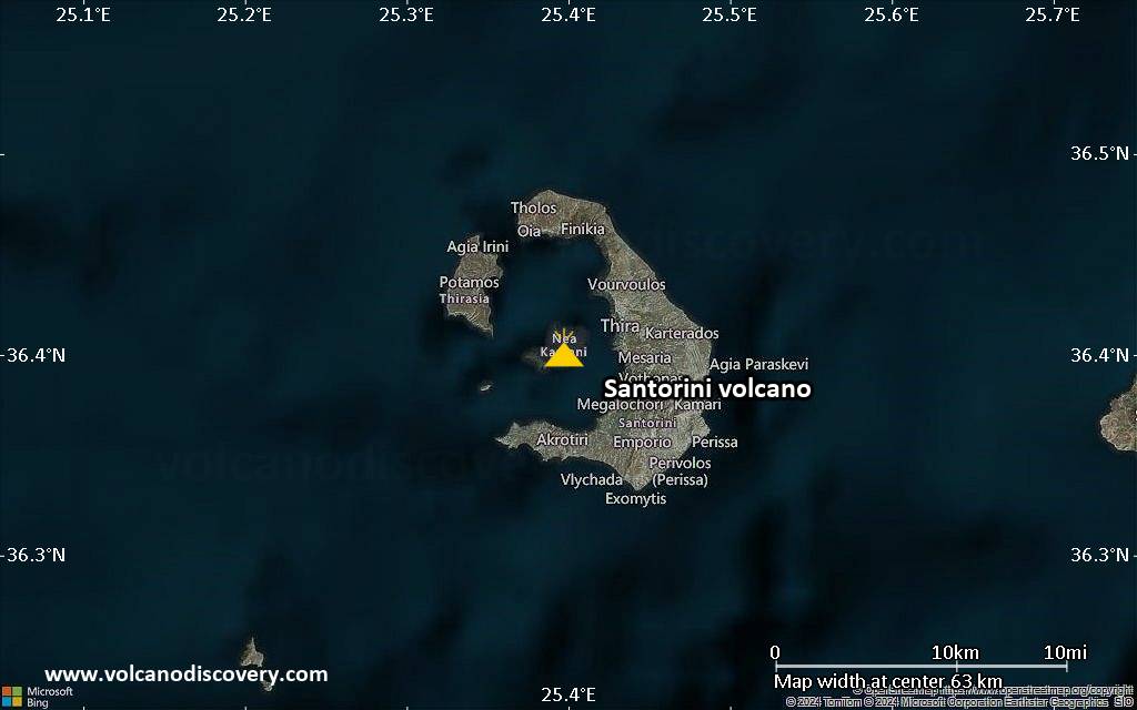
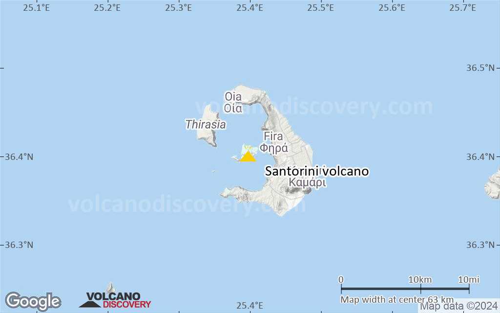
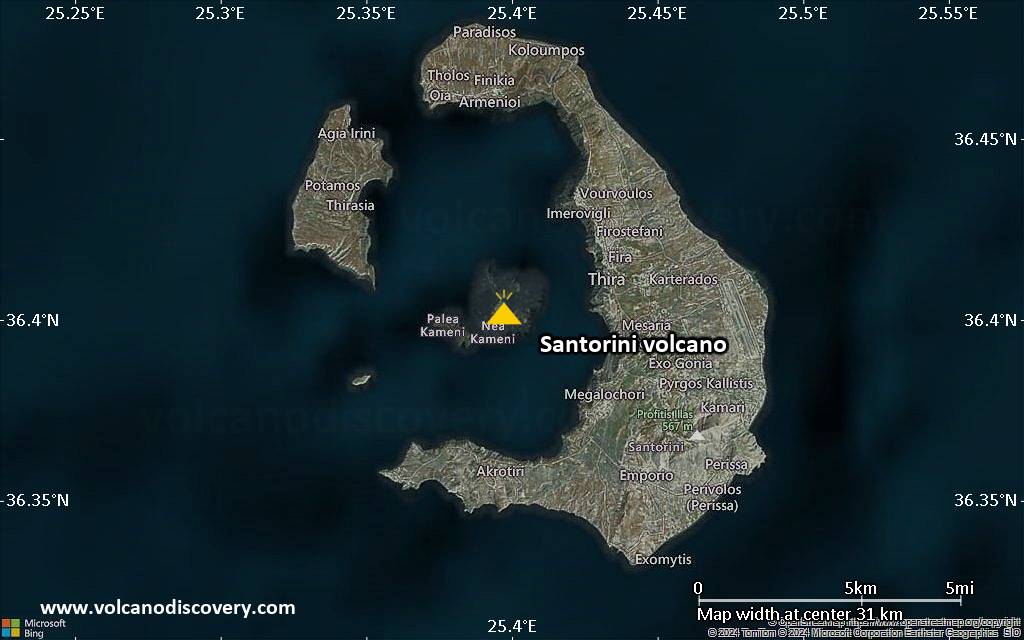
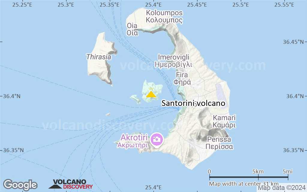
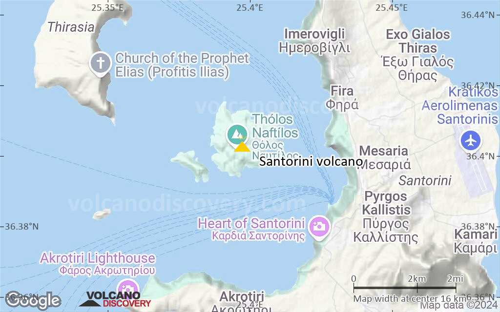
Santorini Volcano
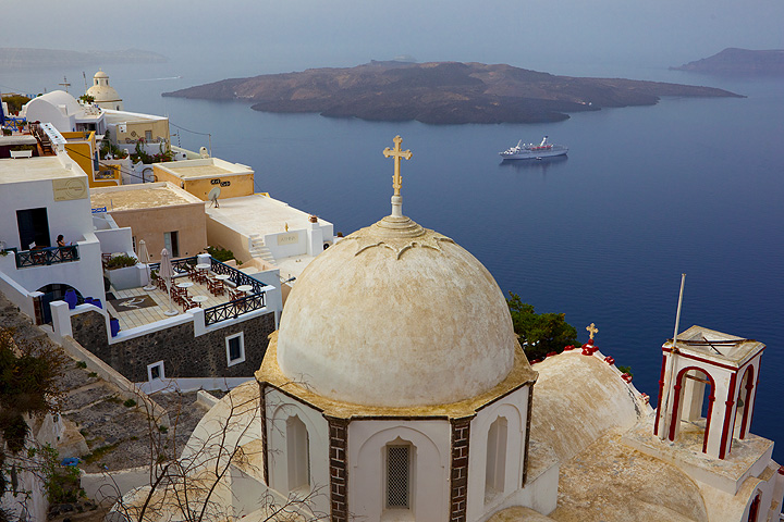
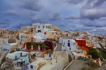
Santorini is a volcanic Island group at the central south end of the Cyclades in the Aegean Sea (Greece). As a popular tourist destination in Greece, it is renowned for its spectacular sea-filled volcanic caldera sourrounded by steep colorful cliffs, the beauty of its villages and fields.
Santorini volcano eruptions: 1613 BC +-7 years (the so-called "Minoan eruption", one of the largest plinian eruptions during the past 10,000 years on earth)
historic eruptions: 197 BC, 46/47 AD, 726, 1570-1573, 1707-1711, 1866-1870, 1925-1928, 1939-1941, 1950
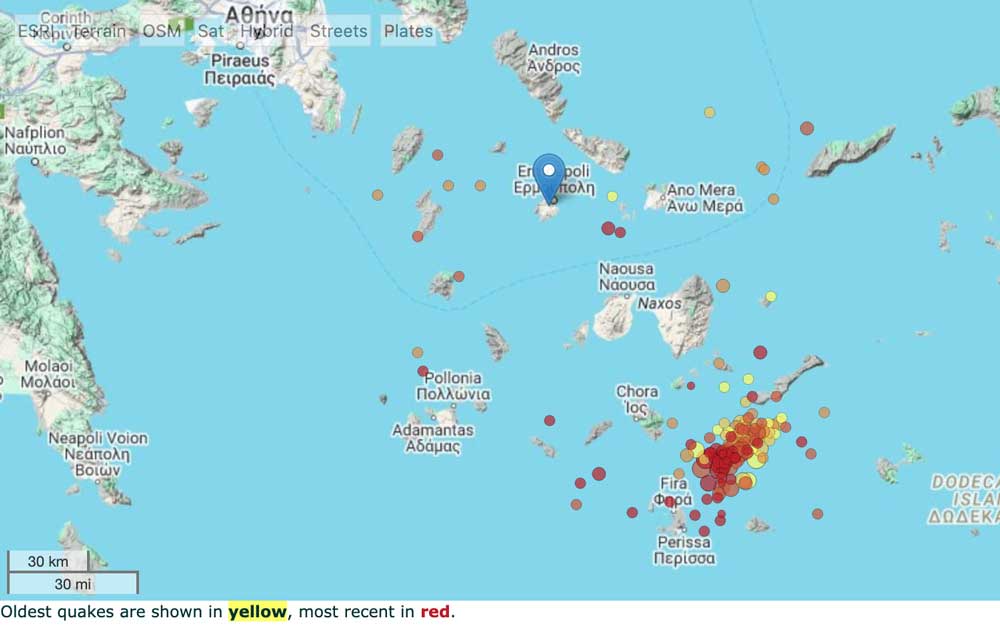
Latest nearby earthquakes
| Date and Time | Mag / Depth | Distance / Location | |||
|---|---|---|---|---|---|
| May 22, 02:53 am (Universal Time) | 0.4 18 km | 12 km (7.2 mi) to the NE | Info | ||
| May 22, 02:22 am (Universal Time) | 0.9 5.4 km | 23 km (14 mi) to the NE | Info | ||
| May 22, 03:45 am (GMT +3) | 1.5 6.5 km | 21 km (13 mi) to the SE | Info | ||
| Wednesday, May 21, 2025 GMT (4 quakes) | |||||
| May 21, 11:34 pm (Universal Time) | 0.9 23 km | 25 km (16 mi) to the NE | Info | ||
| May 21, 11:24 pm (Universal Time) | 0.9 10 km | 25 km (16 mi) to the NE | Info | ||
| May 22, 01:54 am (GMT +3) | 1.2 6 km | 29 km (18 mi) to the NE | Info | ||
| May 21, 10:31 pm (Universal Time) | 0.5 14 km | 16 km (10.1 mi) to the NE | Info | ||
| Sunday, May 18, 2025 GMT (1 quake) | |||||
| May 18, 06:34 am (GMT +3) | 2.4 83 km | 11 km (7.1 mi) to the N | Info | ||
| Saturday, May 17, 2025 GMT (1 quake) | |||||
| May 17, 09:53 am (Universal Time) | 2.4 9.6 km | 25 km (15 mi) to the NE | Info | ||
Background
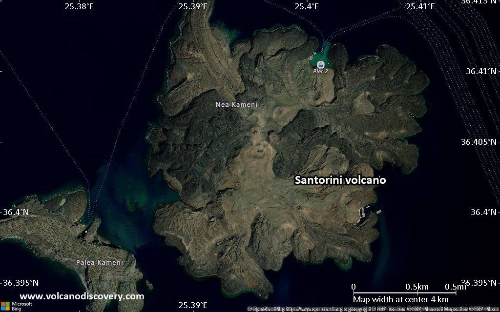
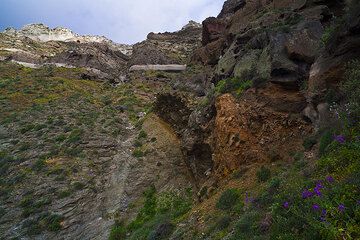
The island group of Santorini is the most well-known and active volcanic centre of the Hellenic Volcanic Arc in the south Aegean Sea. It is a very complex stratovolcano dominated by a large, sea-flooded caldera created by several large explosive eruptions. The different products of about 2 million years of volcanic activity have accumulated around a small non-volcanic basement, that once formed a small island similar to the other cycladic islands. Most of the volcanic layers are visible in the multi-colored sequences of the impressive steep inner walls of the caldera, striking the visitor who reaches the island by boat.The last eruption took place in an phreatic eruption on Nea Kameni island in 1950.The Minoan Eruption
Santorini's volcanic activity during the past 2-500,000 years has been dominated by very large explosive eruptions at intervals of few tens of thousands of years. The most recent of this type occurred at around 1613 BC and is known as the so-called Minoan eruption. The late Bronze Age eruption, one of the biggest known volcanic explosions in younger time,- and one of the most studied, but still most mysterious eruptions of all time-, devastated not only Santorini, but had a deep impact on the whole of the Eastern Mediterranean. Perhaps it even had serious world-wide effects and changed history.
Still today, one can see its deposits, the characteristic, tens of meters thick layer of white pumice and ash that blankets most of the surface of the island group. The eruption changed the shape of the island itself dramatically: it is now believed that before the eruption, it had the shape of an almost complete ring that enclosed an earlier, shallower caldera. Then, large sections of island collapsed into the emptied magma chamber after the eruption, literally disappearing under the sea. The ring-island was breached to the W and NW, and the caldera was significantly widened and deepened.
The Minoan eruption devastated the rich, highly developed economic center, that Santorini was at that time. Since 1969, intense archaeological excavations have brought to light an important Cycladic/Minoan town which had been buried beneath the volcanic ash for almost 4000 years. Although it appears that people had time to evacuate their island in time before the eruption, carrying most of their goods with them, the findings from Akrotiri are impressive: especially, they include well-preserved and magnificent wall paintings, ceramics and other objects. Thanks to the work of numerous archaeologists, a new light was thrown on an important prehistoric period and culture. The spectacular discovery even induced continuing speculations that relate the volcanic destruction of Santorini to the legend of the sunken Atlantis.
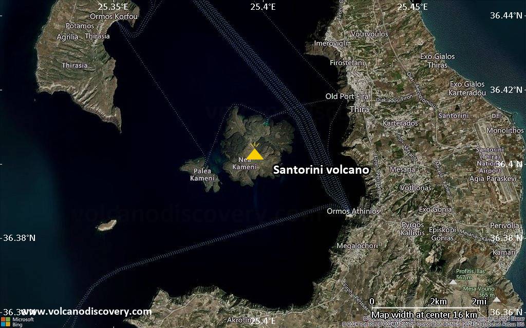
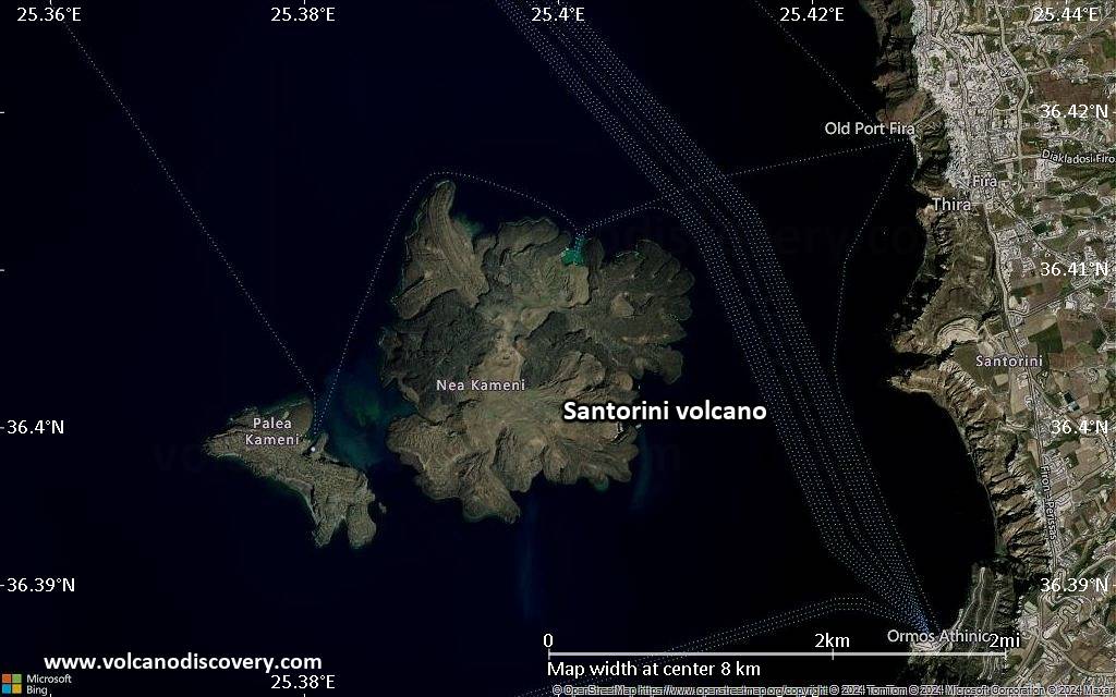
The historic eruptions of Santorini volcano (Palea and Nea Kameni)
Although at present dormant, Santorini has been active several times in historic time. Since its last major explosive eruption (at about 1645 BC) numerous minor and medium-sized, mainly effusive eruptions have occurred. This activity built the dark-colored islands of Nea and Palea Kameni inside the caldera. Their first appearance was witnessed and reported by Greek and Roman writers. The last eruption on Nea Kameni occurred in 1950. At present, Santorini is dormant, and volcanism manifests as fumarolic activity and hot springs around the islands.
Santorini Volcano Photos
Significant volcanic eruptions: Santorini volcano
There is one uncertain or discredited eruption in 19 AD from Santorini volcano.
| Date | Note | VEI | Deaths | Damage | ||
|---|---|---|---|---|---|---|
| Nea Kameni (Liatsikas dome) Historical obs./docs. | 2 | |||||
| Nea Kameni (Triton, Ktenas, Fouque domes) Historical obs./docs. | 2 | |||||
| Nea Kameni (Naftilos dome) Historical obs./docs. | 2 | |||||
| 1928 Jan 23 (eruption | Historical obs./docs. | 2 | 48 | Info | ||
| Nea Kameni (Dafni dome) Historical obs./docs. | 2 | |||||
| Georgios, Afroessa and Reka domes Historical obs./docs. | 2 | |||||
| 1866 Feb 20 (eruption | Historical obs./docs. | 2 | 1 | Info | ||
| Nea Kameni Historical obs./docs. | 3 | |||||
| 1707 May (eruption | Tsunami recorded Historical obs./docs. | 3 | Info | |||
| Colombo Bank (6.5 km NE of Thera) Historical obs./docs. | 4? | |||||
| 1650 AD Sep 26 (eruption | Kolumbo volcano 6.5 km NE of Santorini Tsunami recorded Historical obs./docs. | 4 | 120 | light | Info | |
| Mikri Kameni Historical obs./docs. | 3 | |||||
| 1050 AD (eruptive episode | Tsunami recorded Historical obs./docs. | 0 | ||||
| NE side of Thia Island Historical obs./docs. | 4? | |||||
| Thia Island Historical obs./docs. | 3 | |||||
| 46 AD (eruption | Tsunami recorded Historical obs./docs. | 3 | Info | |||
Discredited Eruption | ||||||
| -197 BC (eruption | Tsunami recorded Historical obs./docs. | 3 | Info | |||
| Hiera Island Historical obs./docs. | 3 | |||||
| -1610 BC (eruption | Tsunami recorded Historical obs./docs. | 7 | 100-1,000 (*) | heavy | Info | |
| Plinian "Minoan" eruption; Central and northern caldera area | 7? | |||||
Eruptions of Santorini volcano
10. Jan. 1950 - 2. Feb. 1950: Small effusive activity ("Liatsikas" lavas) preceded by phreatic explosions.
More info
20. Aug. 1939 - July 1941 -- Formation of several lava domes ("Tritona", "Ktenas", "Fouqué", "Smith-Reck" and "Niki"). Extrusive and slighly explosive activity. Lava outflow in most cases preceeded by phreatic explosions.
more info
11. Aug. 1925- 17. March 1928 -- Moderate effusive and explosive activity. Growth of Nea Kameni. Lava flows, lava fountains and ash-falls.
- Aug. 1925 -- Rising temperature in the Red bay ("Kokkina Nera", gr. = red waters) at the eastern shore of Nea Kameni and subsidence of Nea Kameni's east shore. Vapor fountains and lava outflow. ...more info
4. Feb. 1866 - 15. Oct. 1870 -- Moderate effusive and minor explosive activity. Mikri and Nea Kameni unite. Lava flows, lava fountains and ash-falls. ...more info
No volcanic activity occurred during 1711-1866. Mikri and Nea Kameni were 2 separated islands forming 2 natural bays (Georgios and Vulkano bay). Sulfuric fumaroles in Vulkano bay. Building of a small harbor and ca. 50 summerhouses (!) on Nea Kameni.
23. May 1707 - Sept. 1711 -- Formation of Nea Kameni (gr., = "the new burnt island"). Strong surtseyan and effusive activity. Ash-fall and gas explosions. Lowering of the coastline of Thera and Mikri Kameni. ...more info
27. Sept 1650 -- Kolumbo submarine volcano (ca. 8 km NE of Cape Kolumbo, Santorini): strong surtseyan-subplinian eruption with ash and pumice fall, toxic gasses (>50 fatalities). Generation of a strong tsunami.
more info on Kolumbo volcano
Formation of Mikri Kameni (gr., = "small burnt island"). Surtseyan activity, ash-fall and block fall-out accompany the formation of a lava dome which rises above sea level to form the new island Mikri Kameni.
Unclear reports from Athanasius Kircher (1665) and Buondelmonte (1465/66) indicate that either a part of Palea Kameni collapsed and disappeared or a new island between Palea Kameni and Thera was built.
Strong explosive probably sub-plinian eruption. Records by Nicephoros (758-823), Theophanes (752-818) and Cedremus (after 1059). Probably small effusive activity following the pumice eruption creating the black blocky lava lobe at Agios Nikolaos (the small harbor bay with the church and hot iron springs).
No reports of activity are known from that period. There was either actually no eruption or it has not been recorded.
Appearance of a new island that probably grew together with Hiera and formed the basis of Palea Kameni. Descriptions by Roman historians Seneca (4 BC-65 AD), Livy (59 BC-AD 17), Pliny the Elder (23-79 AD), Dio Cassius (ca. 200 AD), Aurelius Victor (4th century AD), Philostratos (ca. 200 AD), Orosius (5th century AD), Cassiodorus. (418-562 AD), Labbreus (1670). Probably surtseyan activity with updoming of the sea-floor.
Formation of an island called Hiera (gr., = "the holy one") inside the caldera, probably a precursor of Palea Kameni. Documented by greek and Roman writers: Strabo (66BC - 24 AD), Plutarch (ca. 40-120 AD), Pausanias (ca.120 AD), Justinus (2nd century AD), Eusebius from Cesarea (270-340 AD) and Ammianus Marcellinus (ca. 330-400 AD). Probably surtseyan activity with updoming of the sea-floor (comparable with the 1707-1711 events).
The most recent plinian eruption on Santorini occurred in the late Bronze Age at around 1613 BC and is known as the so-called Minoan eruption. It is one the biggest known volcanic explosions in younger time,- and one of the most studied, but still most mysterious eruptions of all time-. It devastated not only Santorini, but had a deep impact on the whole of the Eastern Mediterranean. Perhaps it even had serious world-wide effects and changed history.
Size of the Minoan eruption
Dating of the Minoan eruption
Still today, one can see its deposits, the characteristic, tens of meters thick layer of white pumice and ash that blankets most of the surface of the island group. The eruption changed the shape of the island itself dramatically: it is now believed that before the eruption, it had the shape of an almost complete ring that enclosed an earlier, shallower caldera.
Large sections of island collapsed into the emptied magma chamber after the eruption, literally disappearing under the sea. The ring-island was breached to the W and NW, and the caldera was significantly widened and deepened.
The Minoan eruption devastated the rich, highly developed economic center, that Santorini was at that time. Since 1969, intense archaeological excavations have brought to light an important Cycladic/Minoan town which had been buried beneath the volcanic ash for almost 4000 years. Although it appears that people had time to evacuate their island in time before the eruption, carrying most of their goods with them, the findings from Akrotiri are impressive: especially, they include well-preserved and magnificent wall paintings, ceramics and other objects. Thanks to the work of numerous archaeologists, a new light was thrown on an important prehistoric period and culture. The spectacular discovery even induced continuing speculations that relate the volcanic destruction of Santorini to the legend of the sunken Atlantis.
Santorini Volcano FAQ
+When was the last eruption of Santorini volcano?
The last confirmed eruption of Santorini occurred in 1950.
+How often does Santorini volcano erupt?
Since 197 BC, Santorini volcano has had at least 11 historically documented eruptions. This means that it erupts on average every 202 years.
Many eruptions of Santorini have lasted more than one year. In total, the volcano has been in eruption during 26 out of 2222 years until now. In other words, Santorini has been active at least one in 85.5 years on average. Note that this value is likely an underestimate, because the known history of eruptions from Santorini is likely incomplete, especially further back in time.
+How active is Santorini volcano at present?
Santorini volcano is infrequently active: Since 1900, it has had 7 eruptions, and been active during 7 years out of 126 as of now. This means, Santorini has been in eruption one in 18 years on average. The last eruption was in 1950 and ended 75 years ago.
+When was the largest eruption of Santorini volcano?
The largest eruption known from the younger geological history of Santorini volcano occurred around 1610 BC. It ranks as a sub-plinian eruption with a magnitude 4 on the VEI (Volcanic Explosivity Index) scale.
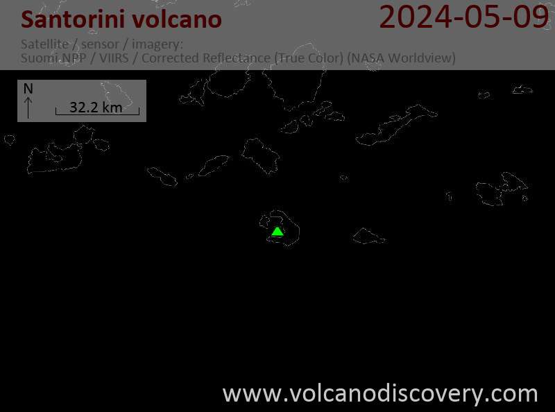
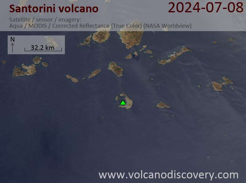
Latest satellite images
Price from 750 EUR
Price 1890 €
Santorini Volcano Maps