Mexico's volcanoes are part of the Pacific Ring of Fire and formed on the North American continental tectonic plate under which the oceanic Pacific and (in the south) Cocos plates are being subducted.
The most active volcanoes of the country are Popocatepetl, Colima and El Chichon, which had a major eruption in 1982 that cooled the world's climate in the following year.
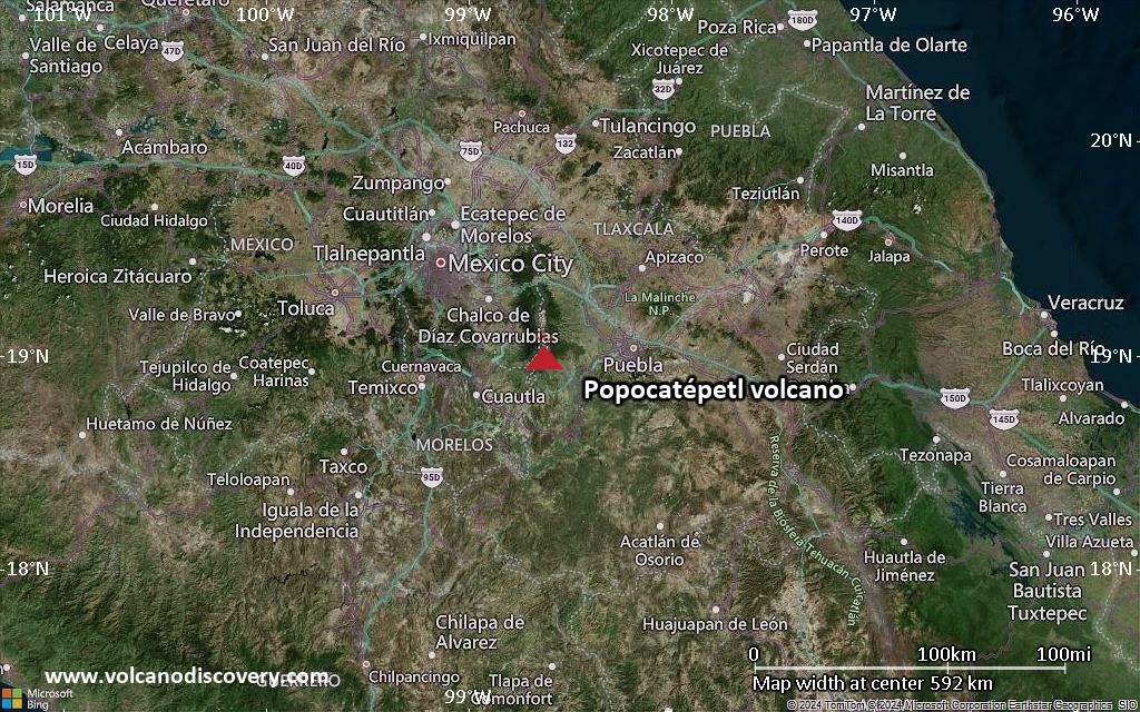
All active volcanoes of Mexico are listed.
| Date | Volcano | VEI | Region | Deaths | Damage | |
|---|---|---|---|---|---|---|
| Popocatépetl | 2 | Central Mexico | ||||
| 2022 Jun 22 (eruption | Popocatépetl | 2 | Central Mexico | 1 | Info | |
| Colima | 1 | Western Mexico | ||||
| Colima Summit crater | 3 | Western Mexico | ||||
| Colima 1994 crater | 3 | Western Mexico | ||||
| Popocatépetl | 2 | Central Mexico | ||||
| Popocatépetl | 3 | Central Mexico | ||||
| 1996 Apr 30 (eruption | Popocatépetl | 3 | Central Mexico | 5 | light | Info |
| Popocatépetl | 2 | Central Mexico | ||||
| Colima West of 1987 explosion crater | 1 | Western Mexico | ||||
| Socorro Submarine vent 3 km W of Punta Tosca | 0 | Revillagigedo Islands, Mexico | ||||
| Colima | 2 | Western Mexico | ||||
| Colima East side of summit lava dome | 1 | Western Mexico | ||||
| Colima | 1 | Western Mexico | ||||
| El Chichón | 5 | Southern Mexico | ||||
| Colima | 1 | Western Mexico | ||||
| 1982 May 27 (eruption | El Chichón | 5 | Southern Mexico | 1 | Info | |
| 1982 Apr 4 (eruption | El Chichón | 5 | Southern Mexico | 33 | Info | |
| 1982 Mar 29 (eruption | El Chichón | 5 | Southern Mexico | 1,879 | moderate | Info |
| Colima | 2 | Western Mexico | ||||
| Colima | 1 | Western Mexico | ||||
| Colima | 1 | Western Mexico | ||||
| Colima | 1 | Western Mexico | ||||
| Bárcena South end of Isla San Benedicto | 3 | Mexican Islands (Mexico) | ||||
| Michoacán-Guanajuato Parícutin | 4 | West-Central Mexico | ||||
| Socorro SW flank (west of Lomas Coloradas) | 2? | Revillagigedo Islands, Mexico | ||||
| Popocatépetl | 1 | Central Mexico | ||||
| 1943 Feb 20 (eruption | Michoacán-Guanajuato | 4 | West-Central Mexico | 103 | Info | |
| Popocatépetl | 1 | Central Mexico | ||||
| Popocatépetl | 1 | Central Mexico | ||||
| Colima | 1? | Western Mexico | ||||
| Popocatépetl | 2 | Central Mexico | ||||
| Popocatépetl | 1 | Central Mexico | ||||
| Popocatépetl | 1 | Central Mexico | ||||
| 1919 Feb 19 (eruption | Popocatépetl | 1 | Central Mexico | 50-100 (*) | Info | |
| Colima | 4 | Western Mexico | ||||
| 1913 Jan 20 (eruption | Colima | 4 | Western Mexico | 13 | Info | |
| Colima | 3 | Western Mexico | ||||
| Colima | 1? | Western Mexico | ||||
| Colima | 3 | Western Mexico | ||||
| Colima | 2 | Western Mexico | ||||
The last volcanic eruption in Mexico was from Colima volcano in 2019.
The first historically documented eruption occurred around 1345 AD from Popocatépetl volcano.
Since 1345 AD, Mexico has seen at least 103 historically documented eruptions. This means that a volcano erupts on average every 6.6 years.
Mexico is volcanically very active: Since 1900, at least 6 volcanoes in Mexico have been active.Since 1900, Mexico has had 33 volcanic eruptions from 6 individual volcanoes. Volcanic eruptions have been recorded erupted during 95 years out of 126 as of now. This means, at least one volcano in Mexico has been in eruption in one in 1.3 years on average. The last volcano to erupt in Mexico was Colima volcano, which erupted in 2019, 6 years ago.
The largest eruption in Mexico in historic times was from El Chichón volcano. It occurred in 1982. It ranks as a plinian eruption with a magnitude 5 on the VEI (Volcanic Explosivity Index) scale. Eruption of this size are often catastrophic on a regional scale.
| Date and Time | Mag / Depth | Nearest Volcano / Location | |||
|---|---|---|---|---|---|
| May 20, 02:36 am (Mexico City) | 4.3 57 km | 254 km (158 mi) SW of | 45 km northeast of Miahuatlan de Porfirio Diaz, Estado de Oaxaca, Mexico I FELT IT - 4 reports | Info | |
| Monday, May 19, 2025 GMT (1 quake) | |||||
| May 18, 11:56 pm (Mexico City) | 4.2 30 km | 354 km (220 mi) SW of | 44 km west of Crucecita, Estado de Oaxaca, Mexico I FELT IT | Info | |
| Sunday, May 18, 2025 GMT (1 quake) | |||||
| May 17, 07:42 pm (Mexico City) | 4.4 27 km | 235 km (146 mi) S of | 28 km northwest of Acapulco de Juárez, Estado de Guerrero, Mexico I FELT IT - 2 reports | Info | |
| Friday, May 16, 2025 GMT (1 quake) | |||||
| May 16, 08:52 am (Mexico City) | 4.5 5.3 km | 130 km (81 mi) S of | 43 km northwest of Ciudad Lazaro Cardenas, Estado de Michoacan de Ocampo, Mexico I FELT IT | Info | |
| Thursday, May 15, 2025 GMT (2 quakes) | |||||
| May 15, 03:14 am (Mexico City) | 4.3 167 km | 121 km (75 mi) W of | 76 km south of Minatitlán, Estado de Veracruz-Llave, Mexico I FELT IT | Info | |
| May 15, 12:12 am (GMT -7) | 4.3 10 km | 309 km (192 mi) NW of | North Pacific Ocean, 283 km southwest of Puerto Vallarta, Mexico I FELT IT - 2 reports | Info | |
| Date | Mag | Region | Deaths | Damage | |
|---|---|---|---|---|---|
| 2017 Sep 19 | 7.1 | Mexico City, Morelos, Puebla | 369 | catastrophic | Info |
| 2017 Sep 8 | 8.2 | Oaxaca, Chiapas, Tabasco; Guatemala | 98 | catastrophic | Info |
| 2003 Jan 22 | 7.5 | Villa De Alvarez, Colima, Tecoman, Jalisco | 29 | heavy | Info |
| 1999 Sep 30 | 7.5 | Oaxaca | 35 | very heavy | Info |
| 1999 Jun 15 | 7.0 | Puebla, Veracruz, Oaxaca, Morelos, Guerrero | 20 | very heavy | Info |
| 1995 Oct 9 | 8.0 | Jalisco, Manzanillo, San Patricio Melaque | 50 | moderate | Info |
| 1985 Sep 21 | 7.6 | Sw Coast Mexico City | 50-100 (*) | moderate | Info |
| 1985 Sep 19 | 8.1 | Michoacan Mexico City | 9,500 | catastrophic | Info |
| 1982 Mar 28 | 3.5 | Chiapas | 1,879 | moderate | Info |
| 1980 Oct 24 | 6.4 | S, Huajapan De Leon, Oaxaca | 300 | moderate | Info |
| 1973 Aug 28 | 6.2 | Veracruz, Mexico City | 600 | heavy | Info |
| 1973 Jan 30 | 7.5 | S, Farias, Tecoman | 56 | moderate | Info |
| 1968 Sep 25 | 6.1 | Mexico-guatemala: S Chiapas | 20 | moderate | Info |
| 1964 Jul 6 | 7.3 | Guerrero | 78 | heavy | Info |
| 1959 Aug 26 | 6.9 | Gulf of Campeche | 25 | heavy | Info |
| 1957 Jul 28 | 7.9 | Acapulco, Mexico City | 65 | heavy | Info |
| 1937 Jul 26 | 7.2 | Central, Puebla Esperanza, Veracruz | 34 | moderate | Info |
| 1932 Jun 22 | 7.7 | Central | 75 | heavy | Info |
| 1932 Jun 3 | 8.1 | Near Coast of Jalisco | 400 | heavy | Info |
| 1920 Jan 3 | 7.8 | Veracruz Cozautlan, Puebla Patlanala | 648 | moderate | Info |
| 1911 Jun 7 | 7.6 | Colima, Jalisco, Mexico City | 100-1,000 (*) | heavy | Info |
| 1900 Jan 20 | 7.3 | Mexico | 50-100 (*) | heavy | Info |
The deadliest earthquake in Mexico since 1900 was the magnitude 8.1 earthquake in ![]() Mexico, Estado de Michoacan de Ocampo on Sep, 19, 1985. It resulted in 9,500 fatalities and 30,000 injured people. A tsunami was generated by the quake as well and contributed to its desctuctive effects. The height of the tsunami waves reached 3 m (10 ft). This was the most disastrous quake in Mexico ever recorded.
Mexico, Estado de Michoacan de Ocampo on Sep, 19, 1985. It resulted in 9,500 fatalities and 30,000 injured people. A tsunami was generated by the quake as well and contributed to its desctuctive effects. The height of the tsunami waves reached 3 m (10 ft). This was the most disastrous quake in Mexico ever recorded.
The earthquake that caused most damage was the magnitude 7.1 earthquake in ![]() Mexico, Estado de Puebla on Sep, 19, 2017. It caused 369 fatalities and estimated $8 billion US Dollars (today's equivalent) in total economic damage.
Mexico, Estado de Puebla on Sep, 19, 2017. It caused 369 fatalities and estimated $8 billion US Dollars (today's equivalent) in total economic damage.
Since 1900, at least 58 earthquakes claimed an estimated total of 15,000 fatalities in Mexico.
There were 100 damaging or deadly quakes during this period that caused economic losses of approx. $19.4 billion US Dollars combined.